As I (Steve) wrote in our last blog post, we're in the Pacific Northwest this summer. We started in northern California and are working our way north from there. This area is marked by volcanoes and evidence of past volcanic activity, some ancient, and some not so long ago. This activity has shaped the topography of the region in many ways, and we've found recurring themes in many different places that we've visited. In this post, we'll look at the water.
When you've spent a fair amount of time in the desert, as we did by spending this past winter in Tucson, you get a bit used to not seeing any rivers, lakes, waterfalls, or rain for a while. So when you get to a place with lots of water, it seems like a major change. Well, the Pacific Northwest has abundant water, and much of it has been shaped by the volcanic activity of the ring of fire.
The picture above is of Burney Falls in northern California. It's one of a series of three waterfalls on a river that flows from Mt. Lassen in Lassen Volcano National Park. These waterfalls are formed by a layer of volcanic rock that flowed over a softer layer of sandstone. The sandstone erodes more readily, leaving a dramatic cliff at the edge of the lava flow. This waterfall is particularly interesting because you can see that one layer is more porous, and the water has seeped in and comes out the side of the cliff face after traveling underground.
This is Shasta Dam, in northern California near Redding. Construction on Shasta Dam began in 1937 during the Great Depression. It was envisioned as a way of providing water to the central valley of California as well as controlling the Sacramento River to prevent flooding. At the time, it was second in height to Hoover Dam, but much wider. (Read more here.) It was completed almost two years ahead of schedule, as World War II had started and the electricity the dam would generate was badly needed for war factories. Shasta Dam gets its water from snow-melt runoff from the mountains that were formed by volcanic activity in the ring of fire. It now provides a dependable source of water for California, as well as inexpensive electrical power and a huge lake for boating and fishing.
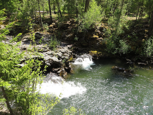
This is the Rogue River in southwestern Oregon. This river flows from snow-melt off the slopes of Crater Lake and runs all the way to the Pacific Ocean. Where we took this picture, high in the mountains, it forms a "natural bridge" by flowing underground through a lava tube for a short distance. Here we are seeing a portion of the river reemerge at the surface, visible in the middle of the top of the picture. It's rather odd to see this sizable, fast-flowing river just disappear into the ground and then reappear 100 yards downstream. It wasn't easy to get any good pictures of it, but I've included a brief descriptive sign to help.
Volcanic lava tubes make this phenomenon possible.
This waterfall is in Silver Falls State Park, near Salem Oregon. The park boasts a collection of 10 or 11 waterfalls, many of which are formed, as this one was, by a layer of hard volcanic rock over a soft layer that has eroded. In many cases, this erosion has left a dramatic overhang. In the photo above, you can see a railing along the hiking trail that goes under the overhang in back of the falls. Look closely and you can see people on the trail.
This shows the dramatic overhang. The geology of these waterfalls results from lava flows from the volcanoes. The water flowing over them comes from the mountains that the volcanoes formed.
Finally, all this water eventually flows to the sea, and while its entrance to the sea may not be so dramatic, the Oregon coast is famous for its scenery. This spectacular coastline was formed not so much by volcanic activity as by the movement of the Pacific Plate sliding under the North American Plate. This creates sharp edges and steeply angled layers, huge rock formations, and an odd bit of sand dune in the middle of it all. I'll end with a bunch of photos of the Oregon coast. Enjoy the show!


