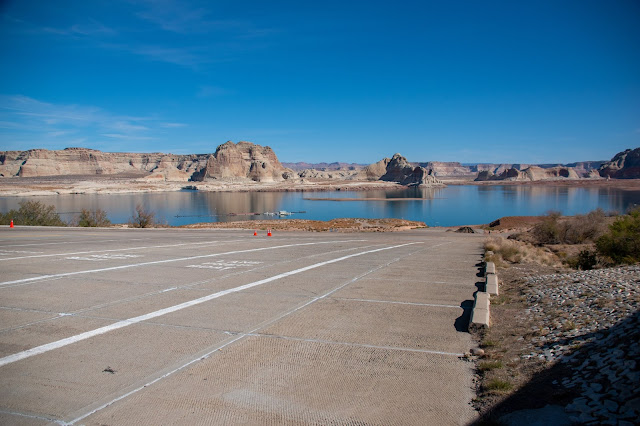
Lake Powell in Page, AZ.
We were here 3 years ago. From the campground we could walk to the water. Back then it was a bit of a hike, not the short walk to the water's edge that it was when Lake Powell was full, some 20 years ago. But now, when you get to where the water was 3 years ago, you still have a quarter mile to go before you reach the water.
Here's Jane standing by the "No Lifeguard" sign that used to be just before you arrived at the water. Look over her left shoulder. Those black dots you see are cars parked in a new parking lot by the new boat launch. That new parking lot is still high above the lake level.
The water in Lake Powell is low. The lake is at around 29% of capacity, and the lake levels will continue to fall until sometime in April or May. The typical cycle is that the lake reaches its low point some time from mid-April to early May. Then the spring melt and runoff from the mountain snows begins and raises the lake level. In some years, the lake will rise over 40 feet in elevation from the spring runoff. In 2021, the lake rose only 2 feet.
The western US is facing a water crisis. Twenty years of drought and an over-allocation of the existing water have brought us to the point where water usage will have to be cut back. Nowhere is this more visible than at Lake Powell and Lake Mead. Both reservoirs are at the lowest point that they have been since they first reached full pool. It's rather shocking to come back after only 3 years and find that the water is down almost 50 feet from where you last saw it.
That strategy will work only for some time. The lake is currently 158 feet down from full and has the potential to drop another 30 feet or more before the spring runoff. Here's the view from the Antelope Point marina, a floating marina that is now so far below the pedestrian ramp leading to it that the ramp is no longer usable. They have had to cut a new path through the rock to access the marina. What will happen when the lake drops some more? I don't see a viable solution.


