
For subscribers who receive this blog via email.
We have completed the update to the email distribution. You should now receive these posts as before.
But, you will need to confirm your email subscription first.
by Steve
We are in Bend, Oregon. This area of central Oregon is considered "high desert" as it gets only around 11 inches of rain per year. But you'd really not know it to look around. There are lakes and rivers (and irrigation canals) all around. And snow--lots of snow--in the Cascade Range. This is an area where volcanoes were once very active.

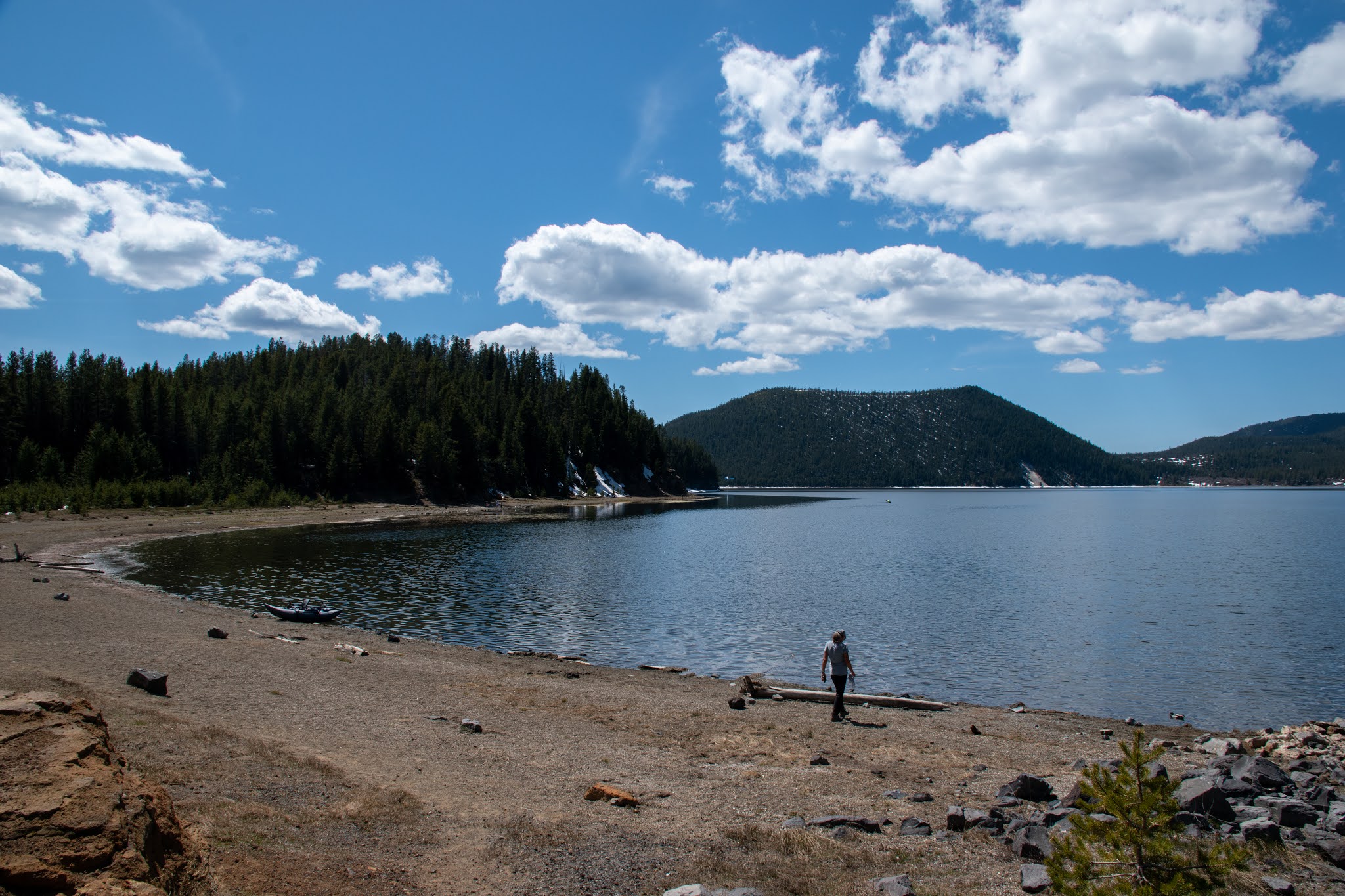
Yes, we are here in May and it's a little early to be up in the mountains. This picture was taken on a recent hike; the trail was under a few feet of snow, and the ski resort on the mountain in the background was still operating. But most of the days have been pleasant with temperatures in the low 60s, so it's just a matter of time for this snow to melt.

This volcano just south of Bend last erupted around 7,000 years ago, leaving this cinder cone. It sits in a field of lava that is a couple miles wide and 6 miles long. It's not uncommon to find both cinder cone volcanoes and lava volcanoes here.

This tree is seemingly growing out of the rock of a lava field, with an older higher volcanic peak in the background. It takes a long time for a lava field to get broken down into soil. But life takes hold, like this ground squirrel who makes the lava field his home.

I'm not sure how he digs a home in the rock, or how he keeps his feet from being cut by the sharp rock, but he seems to be thriving.


Here's a view of Obsidian. It looks pretty but the sharp edges will cut your fingers, and your boots!
The whole area around Bend was covered in lava long ago. It makes an interesting challenge for builders. They need to bust through a few feet of lava before they can put down a foundation for a house. It also makes for some incredible scenery where water flows over and around these lava layers.
 |
| Tumalo Falls, about 10 minutes outside Bend |
 |
| The Deschutes River flowing through a lava field just south of Bend |
In our next post, we'll tell you about a spectacular state park whose volcanic rock is more like sandstone than like lava, and a river that has carved it into a climbers' paradise.
by Steve
In our travels, we will occasionally encounter things that just should not exist. Things that shouldn't be there. The city of Las Vegas is an example--it really has no reason for existing out in the middle of the desert with virtually no resources. This post is about another one of those things: the London Bridge in Lake Havasu City. But first a little history.
The Parker Dam was constructed on the Colorado River about 155 miles downstream from the Hoover Dam. Construction began in 1934 and was completed in 1938. The Hoover Dam was completed in 1936, so these dams were being built at the same time, on the same river. Which also meant that the lakes they created were being filled at around the same time.

Parker Dam created Lake Havasu, and it took four years to fill, completing the lake in 1942. The resulting lake, however, was not an immediate magnet for people. This is, after all, the middle of the desert with no major cities anywhere near it. Here's where the chainsaw comes in.
In 1943, Robert McColloch started a small engine company in Wisconsin. After a few years, he moved the company to California and began manufacturing chainsaws. At first the saws required two men to operate them, but in 1949, McColloch revolutionized the industry by making a one-man chainsaw. Sales took off, and he would go on to change the industry again by making a lightweight chainsaw. (You can read more about the history of McColloch here.)
By 1963, the company had expanded into aircraft engines and outboard motors. While flying over the desert looking at Lake Havasu as a place to test outboards, McColloch thought that it might be a good spot for a city. He had money from his successful chainsaw company and had decided to try real estate development, so he acquired an abandoned military base on Lake Havasu. It cost him nothing, but he was committed to developing the land as part of the deal. The problem was that this was in the middle of the desert with no good way to get there. There was only one unimproved road leading to Lake Havasu in 1964.
Nevertheless, McColloch and his realty partner start advertising, flying people in and selling them lots. But it wasn't enough; he needed something else to lure people, something beyond dry desert, sunshine, and cold river water. His realtor came up with the crazy idea of buying the London Bridge and reconstructing it at Lake Havasu.

The London Bridge, which was the latest one of several constructed on that particular site on the Thames river, had been completed in 1831. The lampposts on the bridge had been made from melted-down cannons captured from Napoleon at the battle of Waterloo.

But by 1924, the bridge had begun sinking due to the weight of automobile traffic, and one end was three to four inches lower than the other. Since it also blocked boat traffic on the river, the city of London decided to see if anyone would be willing to buy it, and they advertised it for sale in 1967.

McColloch and his partner bid $2.4 million for the bridge and ended up getting it. Then they had to get the thing dismantled and moved to Arizona. The London Bridge was an entirely stone structure, way too heavy to move, even after dismantling it. So they kept only the façade and even had all the stones shaved down, losing four to eight inches of depth on each one. The stones were all numbered and shipped off to Arizona, along with the lampposts that lined the bridge. The stones became the facing on a newly constructed steel frame for a bridge that spanned nothing but sand.
Once the bridge was reconstructed, they dredged a channel under it, creating a waterway that connected two parts of Lake Havasu.

The London Bridge at Lake Havasu opened in 1971, and the town has since grown to over 24,000 people. And you can drive over the bridge without fear of it sinking into the desert sand.

So that's how Napoleon's cannons ended up in the Arizona desert, on a bridge that spans a man-made channel that didn't need to be there, except as an excuse for a bridge, in a city that probably shouldn't exist. But it all works.

by Steve
Alternative title:
The Day We Tried to Kill Larry
October 2020: the Coronavirus pandemic was raging in the US, although the spread wasn't as bad as it would get later in the fall. We had just spent the summer in the Tucson area, where they recorded the hottest summer on record in more than 100 years of record keeping. We needed to get out of the desert for a while. So we headed to southeastern Utah, where it's easy to isolate and there are interesting things like pueblo ruins and cliff dwellings to discover.

We invited our friend Larry to come along. Larry lives in Prescott, AZ, and like us had spent the summer doing a whole lot of nothing, wanting to avoid exposure to Covid-19. Larry is a fun guy, pretty adventurous, and (we thought) probably a good hiker. But most important was that Larry's truck has 4-wheel drive. So Larry came up to Blanding, UT, for 5 days or so, and we planned out some places to see.
The area around Blanding is riddled with ancient ruins. The areas of Bears Ears National Monument, Cedar Mesa, and Grand Gulch contain hundreds of these sites. Some are fairly accessible, but many of the sites require multi-day backpacking trips or longs treks down roads requiring vehicles with high clearance. Our Honda HRV couldn't get us to one of the more impressive cliff dwellings, Moon House, because the access road is 8 miles of high-clearance-vehicle road followed by 1.2 miles of 4-wheel-drive road. But since Larry has 4WD, this one was on the table.

Here's our first view of the Moon House, as seen from across the canyon. To get there, however, requires hiking down about 300 feet to the canyon floor and then climbing up the other side to the ruin, with both sides being rather steep. The hike to the ruins starts out easy enough: a nice walk over slickrock to the canyon rim. Once you head down into the canyon, things get a bit more interesting. It's not so much a trail as it is a "route." There's a bit of exposure, but if you did slip and fall, it would take a couple good bounces before you went over the edge and plummeted to the canyon floor below.

These canyons have been sculpted by water erosion of millions of years, and they tend to have harder layers of rock that create rims along the canyon wall. These can be a bit challenging to descend, and harder to ascend. Below is a picture of the canyon where the Moon House is located.

We had to descend one side of this canyon, including going over one of these rims, and then scramble up the other side. This is where things got interesting for Larry. We made it over the rim all right, as earlier hikers had built up a pile of rocks on the ledge below. Without that it would have been a 6 foot drop to the ledge. The trail then continues along the ledge, which gets narrower and narrower (which means that the sheer drop to the canyon floor below gets closer and closer); then the trail eventually plummets down the side of the canyon. That's where Larry decided he had seen enough.

Larry decided that continuing on would be taking on more risk than he was willing to do, and so he said "You go on and see the ruin. I'll wait here for you." That's Larry (above) sitting just off the trail. It's good to know your limits and not go beyond them. Continuing on when that little voice in your head tells you to stop is what gets people in trouble. So, as much as we know that he would have enjoyed seeing the ruin, we didn't push him to continue.
The cool thing about this ruin is that there is a courtyard. Under the deep overhang of rock, an outer wall that encloses a courtyard area. An inner wall creates room tucked into the back of the recess. With this double layer of protection, the inner rooms still show their wall paintings, unaffected by time.

Here's Jane (above), about to scramble through the door in the outer wall. You have to be careful not to touch the wall at all, lest you damage it. Note the openings at the top of the wall for light and air.

Here's Jane in the courtyard, looking into one of the inner rooms. The doorway she came through is that area of sunlight just behind her. Note the white painting on the wall on the left side.

The walls of one of the inner rooms are painted to show the different phases of the moon--hence the name "Moon House." Not much light gets into the room through the single door/window, but fortunately we had been forewarned and hadbrought along headlamps and flashlights.

One of the cool things about this site is that some of the walls are made of mud packed over a thatch work of sticks--kind of a primitive plaster. You can see the hand-prints of the people that made this over a thousand years ago. (And no, Jane is not touching it; her hand is a couple of inches in front of the wall).
The tricky bit about this hike is getting out when you are done. Here you can see us descending back down the canyon side, which is fairly smooth slickrock. Yes, this picture is looking pretty much straight up, and you can see there's nothing to hold onto, so it's best to have really grippy boots.

The trickiest bit is yet to come, which is where you climb and pull yourself up an overhang onto the rim that runs along the canyon wall. This required climbing up a pile of rocks, then scrambling up the rim with pretty much nothing to hold onto. We made it up, with Steve going first and then pulling both Jane and Larry up after. They probably wouldn't have made it out without assistance. Unfortunately, we didn't get a photo, because Steve was too busy hauling Jane and Larry, and Jane and Larry were too traumatized to think of taking pictures. Larry likes to say that we tried to kill him on this hike, but the truth is if we hadn't pulled him out of that canyon, he'd still be there today. So, in a way, we saved his life!
Despite the challenges, this was totally worth doing and we'd do it again in a heartbeat. If at some point you decide to do this one, do some research ahead of time so you're prepared. Here's a good site to check out: https://www.hikingproject.com/trail/7021911/moon-house-ruins. And another one here: http://www.gjhikes.com/2016/10/moon-house.html
You will need a permit, as the Bureau of Land Management allows only 20 people a day to visit the site. You can purchase your permit at https://www.recreation.gov/permits/273374
Happy hiking!
by Steve
Two years ago, we stayed for a short time (4 nights) in Blanding, Utah. This small town in southeastern Utah is not on most people's radar for tourist spots. For us, it was a convenient location for seeing Natural Bridges National Monument and the Needles district of Canyonlands National Park. We didn't know what else might be in the area. What we learned was that this area is just chock-full of rock art, cliff dwellings, and ruins, most of which are not advertised or on any maps of the area. But the folks who run the RV park we stayed at told us of a couple locations where we could see cliff dwellings, and we followed their directions and were amazed at the things we could discover. Here's an example of a dwelling we found in a side canyon off an unmarked trail. We wrote about this back in 2018.

So this year, when we were looking for places to travel where we could avoid crowds and COVID, this area came to mind. This is the site of the Bears Ears National Monument. But with the monument's greatly reduced size, most of the ruins and cliff dwellings that we visited were no longer within the monument's boundaries; rather they are just on BLM land, where they do not have the same protections. These fragile ruins are mostly protected by ignorance -- people don't know they are there, and many are difficult to get to. On our last day here, we hiked to Tower Ruin, which is pretty typical for many of the sites in this area.
Tower Ruin is located just a few miles outside of Blanding. There are no signs to it, nor does it appear on any maps of the area. The trail to it does not appear on any trail maps, nor is it really a trail (there's no trailhead signage, for example), but rather a route. The only way to find this is to follow the directions that previous hikers have left on select websites, in this case gjhikes.com. In our first attempt to locate the trailhead, we missed the spot and continued a few tenths of a mile down the dirt forest service road we were on. We ended up spending about 50 minutes scouring the cliffside for a way down into the canyon before determining that we were not in the right spot. When we did find the right spot, we were able to find the route and begin our descent into the canyon, following cairns left by earlier travelers. Here's our first view of Tower Ruin.


The tower is a two-storey structure, with the beams that formed the floor of the second storey still intact. It's remarkably well-preserved. While it sites on a ledge in an alcove, part of the base appears to be a man-made foundation of mud and rocks. That too has lasted for hundreds of years. Needless to say, we tread carefully here, and do not touch the walls or any other fragile structures.

This pic gives you a sense of scale. I think that the people who built this were likely fairly short, at least compared with modern Americans.
The dwelling sits in a broad alcove, with enough overhead protection for the tower, a granary, and a few other mostly-gone structures, including a kiva.

As with many of the hikes in this area, we saw no one at the trailhead, no one on the trail or at the ruin, and it's remote enough that we heard nothing except the sound of an occasional bird. It's best not to hike these places alone, as there's no telling how long it might be before the next hiker comes along.
In our next installment, we'll describe our hike to the Moon House ruin, which is considerably more difficult to reach.
by Steve
The Bright Angel Trail in the Grand Canyon is quite possibly the most popular hiking trail in the world, based on the number of people that hike at least a portion of it. Millions of people visit the Grand Canyon each year. Bright Angel Trail is readily accessible from popular areas on the South rim, and fairly famous. So who wouldn't want to say that they hiked it, even if it is just a small bit near the top?

I've also heard that it is the most dangerous trail in the world. This claim is not made based on any inherent danger - it's really not that steep and doesn't have bad exposure - but simply on the number of people who hike down only to find themselves without sufficient water, or salty snacks, or energy to hike back out. The National Park Service at Grand Canyon does 200 to 300 rescues each year, many of them on this popular trail.
It's also been called the safest trail in the world, for a number of reasons, including the fact that because so many people hike it, there is always someone coming along who can help. And there is water available at four places along the trail. Plus the park service will station a ranger or volunteer along the trail to watch for people who might be likely to get in trouble. They want to be sure you know how far you plan to go, and that you have sufficient water and food along. They look out for anyone struggling on the way up.
But really the Bright Angel Trail is a time machine. As you hike from the rim to the Colorado River at the bottom, you pass through 1.8 billion years of geologic time, through layers of rock that were deposited long before dinosaurs roamed the earth. But it's not just old stuff; every time we hike the trail we discover something new that we hadn't seen before. This year's hike, our dinosaur hunt, was no different. For one thing, we encountered this woman on the trail.

She had brought her own horse to the canyon, and she's wearing what appear to be an Edwardian-era riding suit, and sitting side-saddle on her horse. I'm guessing there's an English side-saddle under that modesty blanket. She was happy to pose for a picture, with ours probably being just one of hundreds that were taken of her that day. (And yes, she gave us permission to use her photo in this blog.)
Going a little further back in time than the100 or so years ago that this riding outfit evokes, we find some pictographs that are missed by most hikers.

These are just below the rim. They were probably painted 800 to 1000 years ago by the people who lived here at the time. While the pictures are not very clear anymore, what is clear is that the south rim had lots of deer and elk back then, as it does now.
Our hike this year had a very specific mission. We wanted to find a rock that has clear dinosaur tracks on it, impressions that were made roughly 313 million years ago. In 2016, there was a rockfall along the trail. This happens fairly often in sections of the trail with vertical rock walls that are subject to freezing and thawing. The park service maintains the trail by moving the rocks that have fallen off to the side of the trail so that hikers can pass safely. In this case, one of the fallen rocks now exposed had dinosaur footprints on it.

Since the rock fall happened four years ago, hundreds of hikers have passed this rock every day, most without noticing what they are walking past. Jane and I have passed this spot at least five times since the rock fell and did not see the tracks. The story recently came to light when USA Today published an article about it. You can read it here. Here are the basics: In 2016, shortly after the rock fell, a geology professor from Norway was leading a group of students up the Bright Angel Trail when he spotted the rock with the dinosaur tracks. He alerted a paleontologist friend at the University of Nevada, who then brought a team to study the rock and analyze the tracks on it. Their research on it was published this summer, and that's when USA Today picked up the story. Read the research paper here.

This rock probably belongs in a museum, where it would be protected from damage. We did not touch the impressions, lest the oils from our hands damage the stone. But moving a rock of this size is no small challenge in a place where the standard mode of transport is by mule. And so the rock stays put for now. Needless to say, the park service does not advertise the exact location of the rock, and so it remains protected, largely by ignorance.

When we decided to locate this rock, all we knew was that it was along the Bright Angel Trail. Given that the Bright Angel Trail is 9.5 miles long from the rim to Phantom Ranch, there would be a lot of rocks to look at as we hiked along. Fortunately, there were just enough clues in the research paper and in a video that someone had posted for us to determine the exact spot on the trail. Combining those clues with Google street-view images of the trail (Google had people hike the trail with street-view camera back in 2012), we were able to confirm the exact location on the trail within a few feet. So we dropped a pin at the spot on our Google maps and simply hiked to the spot, which we won't disclose here.

If you are interested in hiking to see this rock, you can send us a message, and if you seem trustworthy, we'll send you the details of its location. As we sat nearby, we watched as numerous hikers passed unknowingly by it. We told a few of the hikers, those that seemed to be likely to respect the rock (generally those carrying camping gear, since we figure anyone willing to carry that much weight probably loves and respects the canyon). A couple who had read the article and knew about the tracks, but didn't know where they were, had stopped for a rest break just 20 feet from the rock, without even knowing it.

We've been up and down the Bright Angel Trail many times. And every time we see something new along the way. This time the new thing was something really, really old.
So, we spent the summer in Tucson. We never thought that we would do that, but the combination of a global pandemic and a friend here who was dying of ALS made us choose to sit tight this summer. When we arrived in Tucson last fall, I remarked to Jane that it would be interesting to be here sometime to witness the "monsoon" season. Didn't expect to do so right away, but here we are. Tucson gets only around 12 inches of rain in an "average" year, with half of it falling in the months of July, August, and September. The rainstorms that produce those totals can be quite spectacular, we've heard. Giant thunderclouds fueled by gulf moisture and triple-digit desert heat result in massive downpours, dry riverbeds suddenly spring to life and fill with water, and many roads you shouldn't drive on, lest you be swept away.

Well, the monsoon rains did not really materialize this year. We had a couple of decent thunderstorms, but they were very localized and didn't really drop much rain. We had one that produced enough rain to make water run down the street and through some nearby arroyos, but the Santa Cruz river has stayed dry all summer. This is the second summer in a row now where they are calling it the "non-soon," as the rains did not come. At this time in an average summer, there would have been 4.6 inches of rain. We've had 1.6 inches.
But we have had heat. Locals told us that June is the hottest month, and when July and August come along, you get these great cooling rainstorms. Well, not so much this year. The month of July set a record for the hottest month in Tucson in 125 years of weather records. That record lasted exactly 31 days, until August 2020 surpassed July and became the hottest month on record. And with it, summer 2020 became the hottest summer on record for Tucson.


This is a wolf spider who surprised us the other night by walking down the side of the house and across the patio where we were sitting. He's about 3 to 4 inches across, and he could really jump. Wolf spiders don't spin webs; they catch their prey by chasing it down. But they're pretty harmless to humans.
Finally, there's a bush that has been blooming all summer. Apparently if it gets just enough water, it will continue to bloom. This is the Mexican bird of paradise.


